September 19, 2026 Post by : Editorial Navigation and Seamanship
The Chowder Wars: How Harbor Towns Fought Over a Bowl of Soup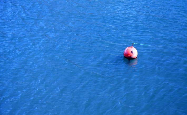
Long before depth sounders pinged the bottom and satellite signals told a captain exactly where he stood, the safest way into a strange harbor was to watch the water. Mariners learned to read a channel the way a tracker reads a forest floor. Color told them depth. Texture told them bottom. Movement told them what lay hidden just beneath the surface.
The palette was surprisingly consistent. Deep blue or green-black water usually meant a scoured channel, kept clear by tidal current. A shift to pale green suggested shoaling sand. Muddy brown often marked a river mouth or a flat where sediment settled. Sailors called this kind of observation "reading the water," and it was a skill passed down by watching, not by reading manuals. A man who could not read the water was not considered a safe pilot, no matter how well he knew the charts.
Texture mattered just as much. A rippling patch on an otherwise glassy surface might mark a submerged rock or the edge of a reef, where current pushed upward. A line of small breaking waves across a channel could reveal a sandbar lying just a few feet down. In calm weather, fishermen watched for "boils" and "slicks" — spots where the water rose or flattened in ways that betrayed the bottom. Old sailing directions sometimes described these telltales in detail, and local knowledge filled in the rest.
The Tools That Helped the Eye
Reading the water was not purely visual. Crews used a range of simple tools to confirm what their eyes suspected. The lead line — a weighted rope marked at intervals — was the most important. A sailor heaved it ahead of the vessel and called out the depth. More than that, the tallow or grease packed into the hollow at the bottom of the lead brought up a sample of the seabed. Sand, mud, clay, gravel, shell: each told a different story. A captain who knew a harbor by its bottom samples could find his position in fog or darkness.
Color and clarity also helped estimate depth. In clear tropical water, a sailor could sometimes see the bottom at ten fathoms. In murky northern harbors, a change from brown to green might be the only sign of a channel edge. The sun's angle mattered, so the best time to read the water was often with the light behind you, low and bright.
Why the Skill Still Matters
Modern electronics have made navigation vastly safer, and no one argues for giving up the depth sounder. But the old skill has not disappeared. Small-boat fishermen, dinghy sailors, and harbor pilots still watch the water for signs. A sudden change in wave pattern can warn of a shoal before the sounder shows it. A patch of calm in a choppy bay can mark a channel. Even in a world of GPS, the water still speaks to anyone willing to look.
The next time you stand on a pier and see a veteran sailor squinting at the surface, watch what he is watching. He may be reading a page that no chart can show: the living, shifting text of the harbor itself.


Author

22 feb,2025
This incident opened my eyes to the value of Insurance in general, so I decided to examine my personal and business insurance.




Comment (3)
The payments are made directly from one person to another without passing through a central bank or clearing house.
22 feb,2025
ReplyThe Iron Mule: How Harbor Cranes Remade the Working Waterfront
23 feb,2025
ReplyFog Signals and the Language of the Harbor
23 feb,2025
Reply